Photogrammetry is well-accepted method of preparing topographic and base maps required for various development works such as urban planning, natural resource management, hazard mapping, hydropower construction etc.
GeoSpatial, in collaboration with Nakanihon Air Co., Ltd, offers a photogrammetric service, process of deriving 3D digital data directly from aerial photographs using 3D Stereo Vision Kit (enables the operator to view and work on 3D images). The accuracy of the digital data produced by this technology is very high.
GeoSpatial, being involved in all aspects of aerial photogrammetry, is committed to provide following
services: –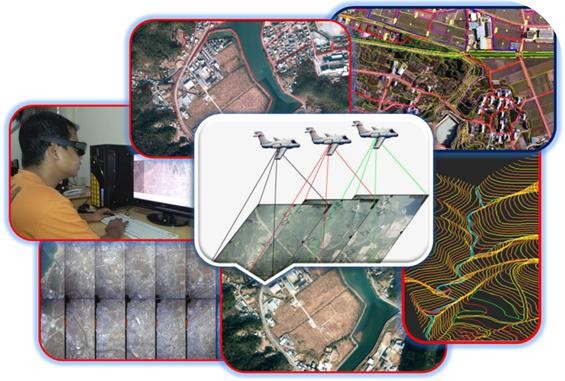
- Digital Aerial Triangulation and adjustment
- Digital Terrain models (DTM) and Digital Surface Model (DSM)
- TIN Model and Orthophoto Maps
- Digital Orthophotos Mosaicing and Rectification
- Generation of 3D city models
Our photogrammetry department comprises of trained professionals from JAPAN and uses first-rate KLT-Atlas and VirtuoZo Digital Photogrammetric workstations equipped with Nu-Vision polarized stereo screens. Product can be delivered in globally accepted formats such as DM, DWG, DGN, DFX and ATL etc.
Potential Areas of Application:
- Urban and Regional Planning
- Land Cover and Land Use analysis
- Thematic Mapping (Topographic Maps, Noise Maps etc)
- Natural Resource Management
- Inventory of natural Hazard and Disaster results
- Hydropower and Infrastructure Construction
- Planning of line objects (roads, transmission lines, pipelines etc.)
- Environmental studies, River changes analysis