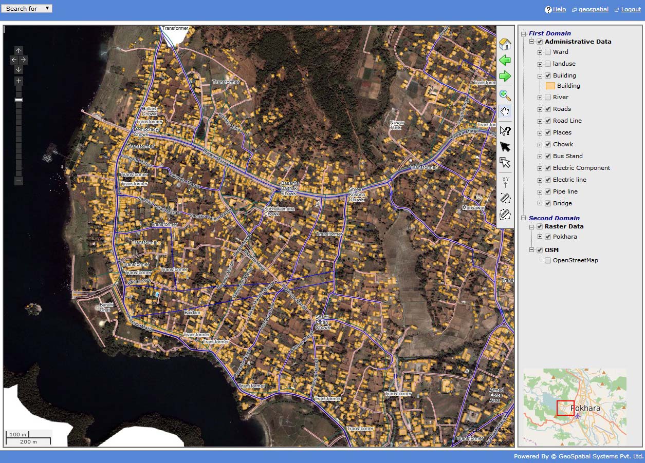
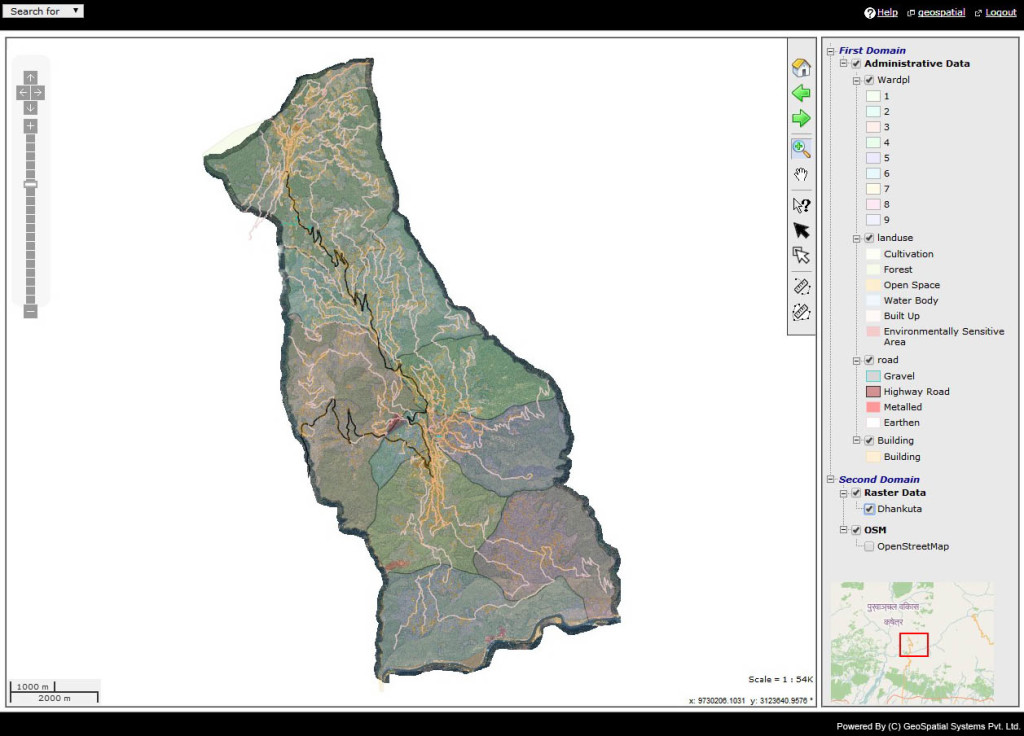
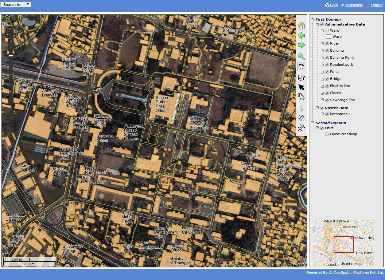
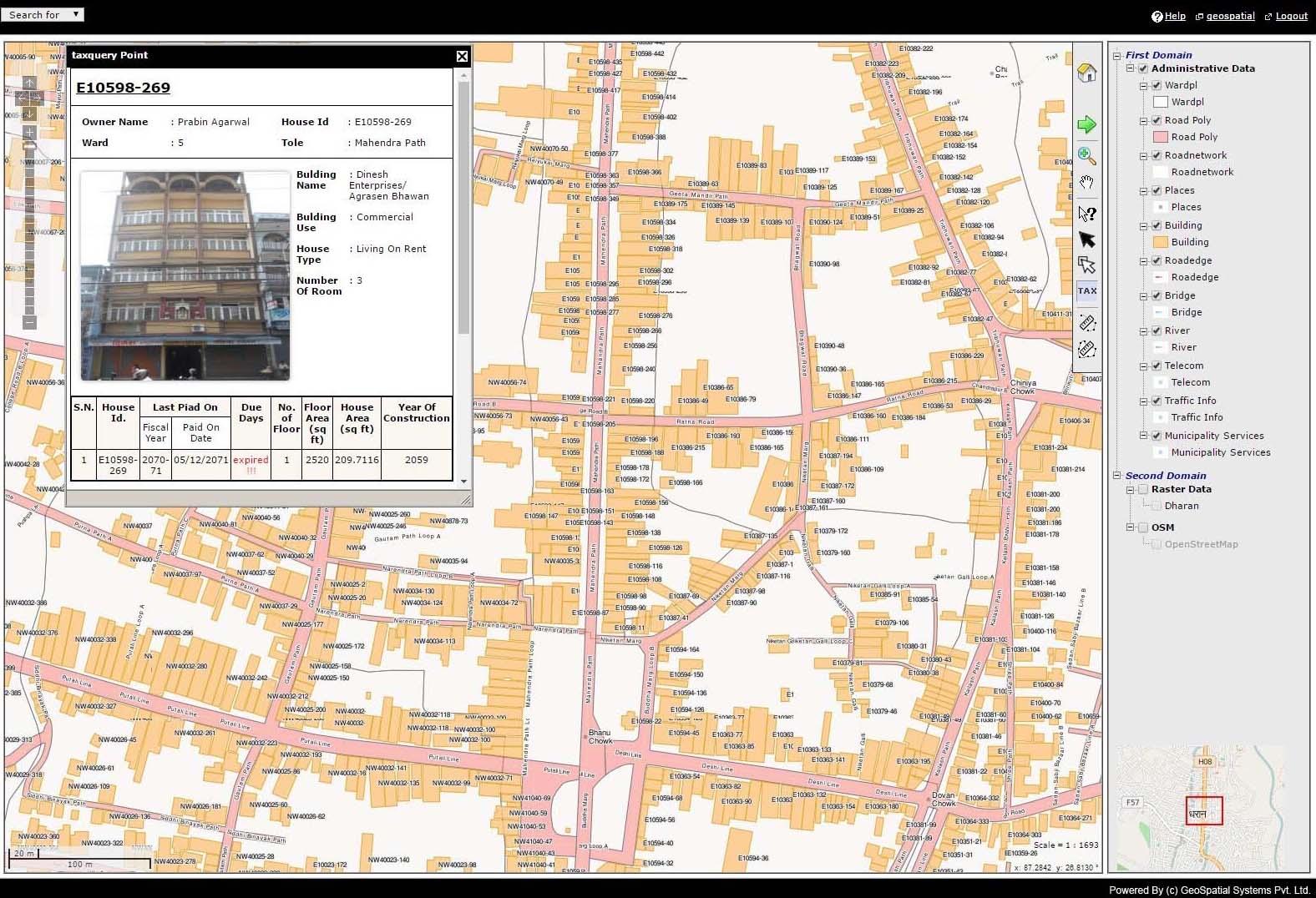
Web-GIS, is a GIS system that uses web technologies to make geographic information available to a very large worldwide audience. It is a type of distributed information system, comprising at least a server and a client, where the client could be a web browser, desktop application, or mobile application. It could also be stated as any GIS that use web technology to communicate between a server and a client. Now with the help of Web-GIS, Internet user will be able to access GIS applications from their browsers without purchasing proprietary GIS Software. The concept of Web-GIS has been emerging in Nepal in recent days. GeoSpatial Systems has been involved in providing Web-GIS service to various organizations.
GeoSpatial System has highly experienced personnel that are capable of creating Web-GIS application of advance standards. We are fully capable of providing Web-GIS service through various means available such as mapserver, geoserver , openlayers etc. We have been developing Web-GIS application that has been designed for simplicity, intuition, and convenience, making it typically much easier to use than desktop GIS. Therefore, extensive people will be able to use it easily without having the knowledge of GIS, as using a regular website. GeoSpatial, being involved in all aspects of web-GIS, is committed to provide following strategies employed in Web-GIS:
- Server side strategies
- Client-side strategies
- Hybrid strategies