ABOUT US

The effective collection and use of geospatial data may provide significantly improved efficiencies in planning and assessing infrastructure projects. To fully support these potential improvements, computational geo libraries are needed to efficiently manage process, customize, and deliver geospatial and remote sensing data to Planners, Managers, Analysts, Engineers, and other stakeholders. In order to provide the quality solution, GeoSpatial Systems Pvt. Ltd. was established in July 1997, commencing various services in Geographical Information Systems (GIS). It is the first joint venture Company of its kind in Nepal. GeoSpatial Systems was formulated in 1997 by its visionary Nepalese Promoters and Japanese renowned Air Survey Company Nakanihon Air Co., Ltd. (NNK), Nagoya, JAPAN. It is also an active member of Computer Association of Nepal (CAN) and Associate member of Federation of Nepalese Chamber of Commerce and Industry (FNCCI).

GeoSpatial workforce comprises of Engineers, Planners, Photogrammatrist, Surveyors, Geographers, CAD Experts, Programmers, GIS Experts, IT professionals and other related professionals. All staff members have received relevant education/ training prior to joining as a part of the organization. The company is fully equipped with Image Processing and Map Digitization workstations. Peripherals like photogrammetric station, LiDAR data processing stations, high-resolution scanners and large size printer & plotters are also available. We have 100 plus workstations besides a number of server system for quality control and data processing to manage large databases. All the computers are set up in Gigabit Local Area Network and connected to the Internet via a dedicated fiber line, which caters for easy and error free data communications with the clients in Nepal and abroad.

SERVICES

With collaboration to Nakanihon Air Co., Ltd, GeoSpatial provides various GIS services which assist different sector to make plan and implement to inhabitant, industrial area, forest conservation, water resource preservation and so on....

LiDAR

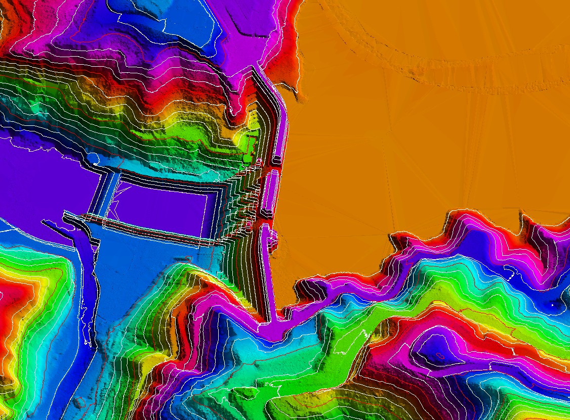
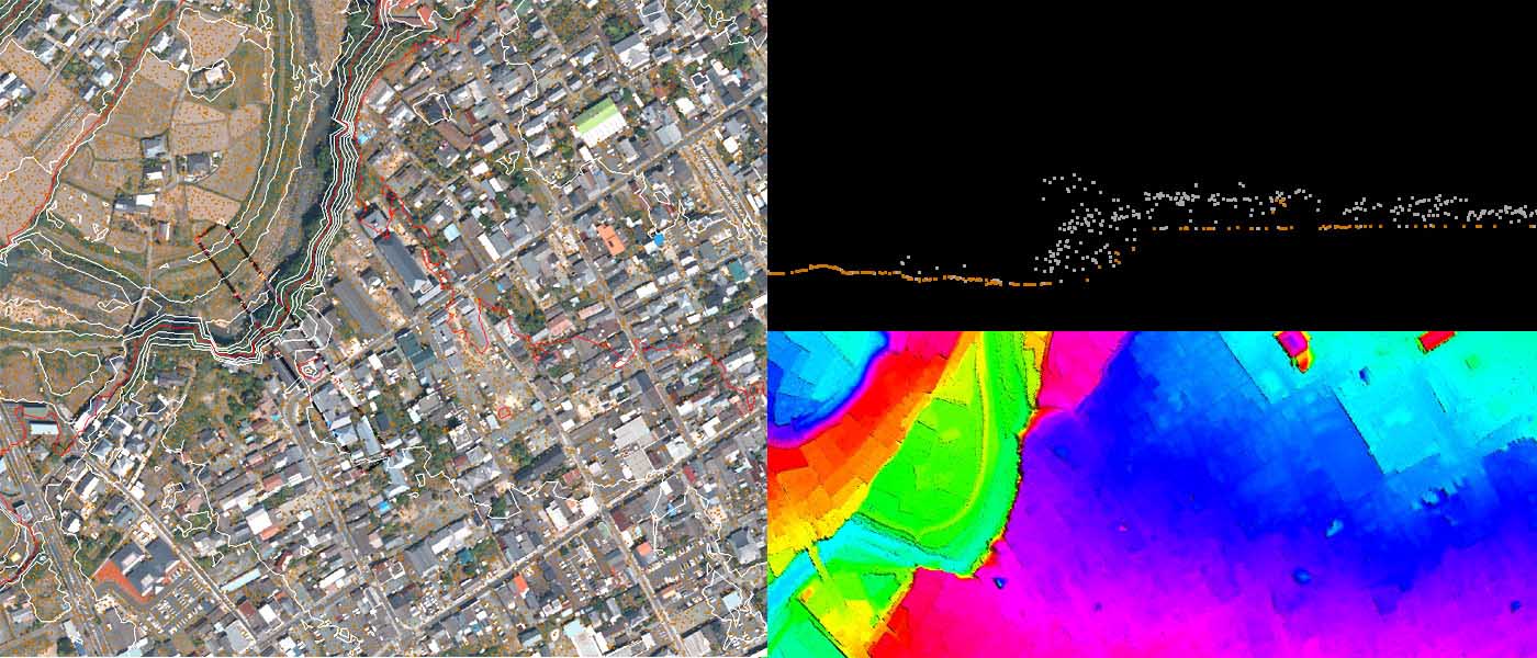
LiDAR, also known as Light Detection and Ranging has become an established method for collecting very dense and accurate elevation values. This active remote sensing technique is similar to radar but uses light pulses instead of radio waves. LiDAR data

Photogrammetry

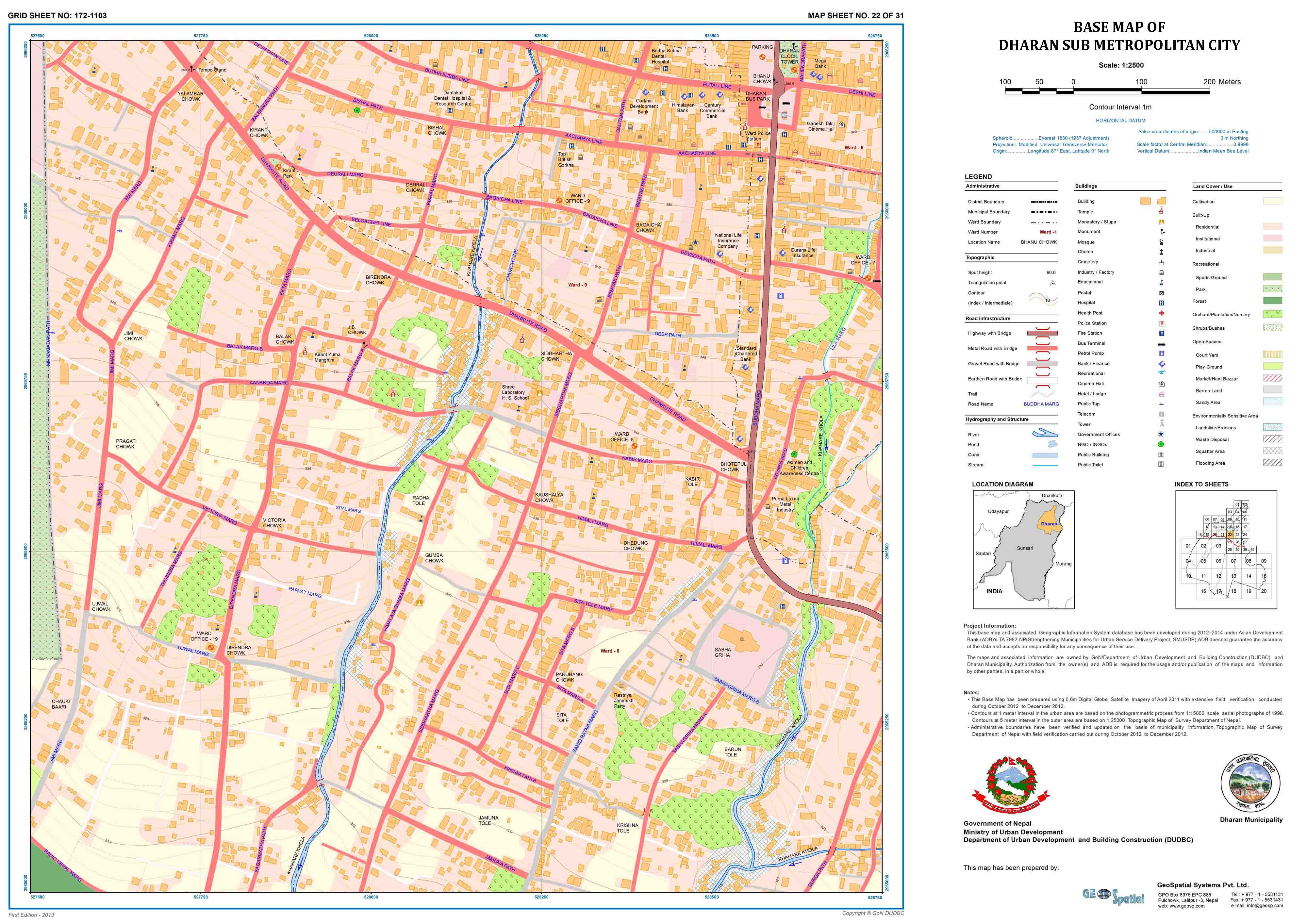
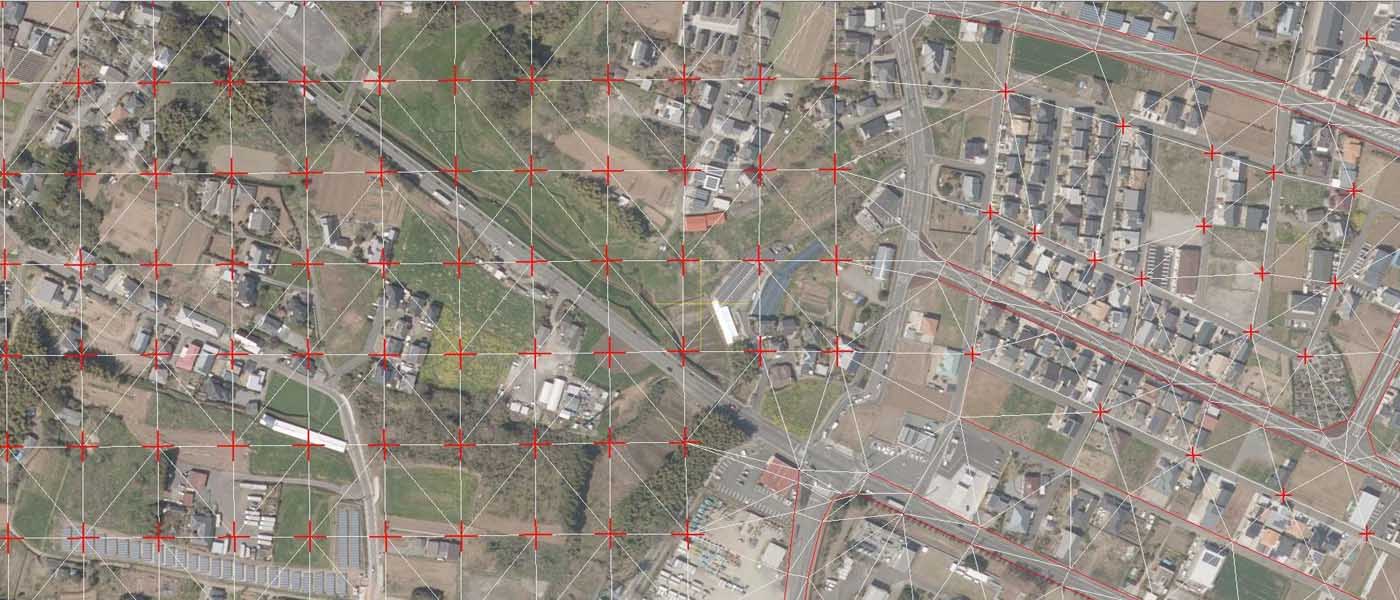
Photogrammetry is well-accepted method of preparing topographic and base maps required for various development works such as urban planning, natural resource management, hazard mapping, hydropower construction etc. GeoSpatial, in collaboration with Nakanihon Air Co., Ltd, offers a photogrammetric service, process

WebGIS

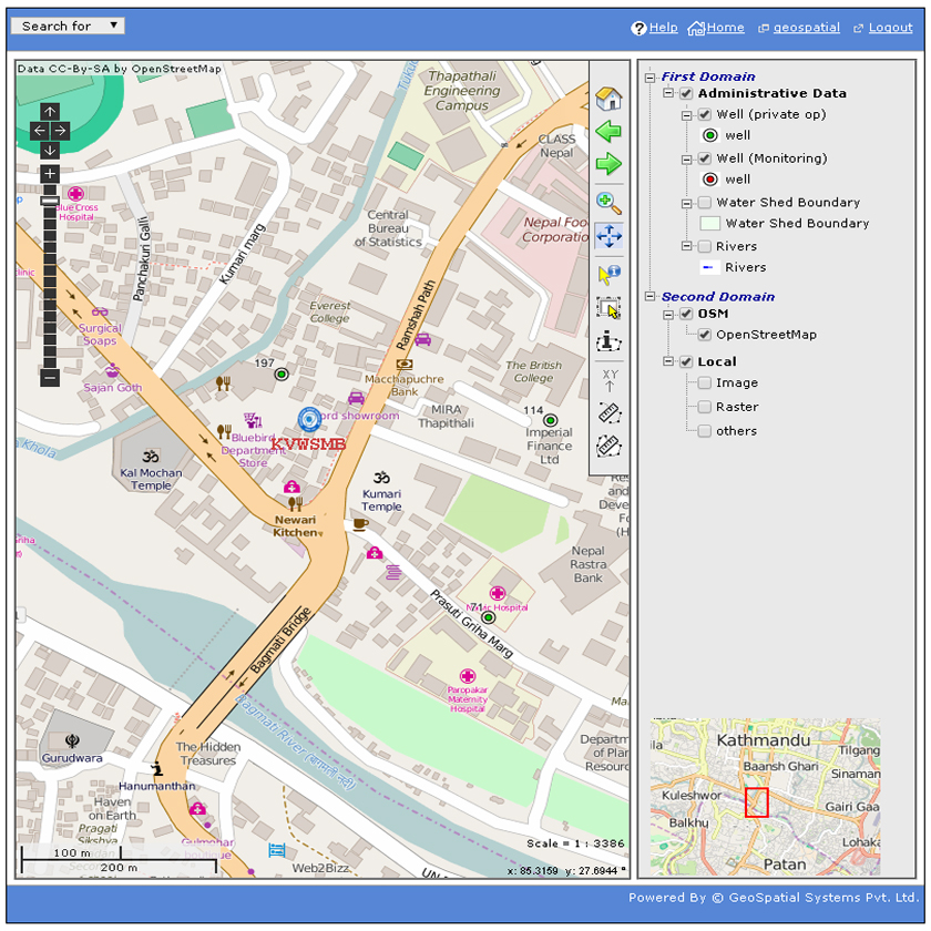
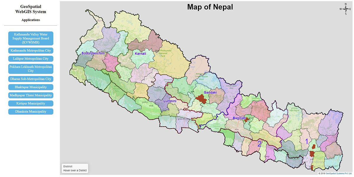
Web-GIS, is a GIS system that uses web technologies to make geographic information available to a very large worldwide audience. It is a type of distributed information system, comprising at least a server and a client, where the client could

One name you can trust for Quality GIS Services: GeoSpatial Systems.