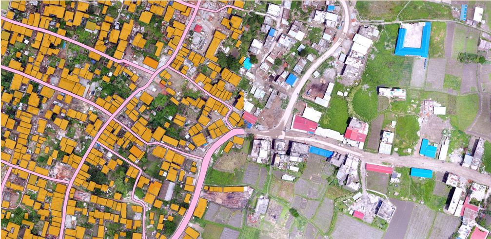
 Shankharapur is a historically rich and remarkable city in the north-east of the Kathmandu Valley. The Municipality covers 60 sq. km area, 5,046 households and 28,338 total populations and divided into 16 wards. The Municipality Office aimed to plan and develop the municipal region as ‘Model City’ through progressively following the concept of “Smart City” for improved urban services and governance system. Digital base map is required for object based planning which is mandatory for smart city. Thus, using a satellite imagery and images taken from drone (UAV) were use to make GIS – based base map.
Importance of Project:
- Basic information about the land, existing physical infrastructure such as type of terrain, drainage system, land use pattern, roads and trails and dwelling pattern etc.
- Digital base maps for planning, implementation, decision-making and construction of development project.
- Important role in efficient designing, physical development planning, implementing municipal plans and programs for micro-level planning
- Database used by municipal applications at a large scale for micro-level planning.
- Provides opportunities to urban services and governance system.
Shankharapur Municipality’s GIS-Based Base Map Preparation